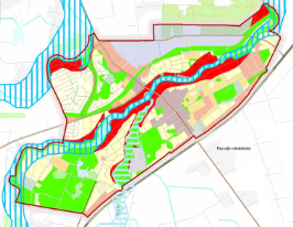
Rengiame valstybės, savivaldybės ir vietovės lygmens bendruosius planus.
Bendrasis planas – kompleksinio teritorijų planavimo dokumentas, kuriame pagal teritorijų planavimo lygmenį ir uždavinius nustatoma planuojamos teritorijos erdvinė struktūra ir teritorijos naudojimo privalomosios nuostatos ir reikalavimai bei apsaugos principai.
© 2024 Valstybės įmonė "Žemės ūkio duomenų centras". Visos teisės saugomos.
| Cookie | Duration | Description |
|---|---|---|
| cookielawinfo-checbox-analytics | 11 months | This cookie is set by GDPR Cookie Consent plugin. The cookie is used to store the user consent for the cookies in the category "Analytics". |
| cookielawinfo-checbox-functional | 11 months | The cookie is set by GDPR cookie consent to record the user consent for the cookies in the category "Functional". |
| cookielawinfo-checbox-others | 11 months | This cookie is set by GDPR Cookie Consent plugin. The cookie is used to store the user consent for the cookies in the category "Other. |
| cookielawinfo-checkbox-necessary | 11 months | This cookie is set by GDPR Cookie Consent plugin. The cookies is used to store the user consent for the cookies in the category "Necessary". |
| cookielawinfo-checkbox-performance | 11 months | This cookie is set by GDPR Cookie Consent plugin. The cookie is used to store the user consent for the cookies in the category "Performance". |
| viewed_cookie_policy | 11 months | The cookie is set by the GDPR Cookie Consent plugin and is used to store whether or not user has consented to the use of cookies. It does not store any personal data. |


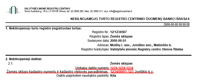
Žemės sklypo (-ų) kadastro arba unikalų (-ius) numerį (-ius) galite sužinoti Nekilnojamojo turto registro centrinio duomenų banko išraše:

Jei Jūsų žemės sklypui yra neįteisinta nuosavybės teisė ir neturite galimybės nurodyti kadastro/unikalaus Nr., prašome nurodyti seniūniją, kadastro vietovę ir žemės sklypo projektinį Nr.
